Portal:Alaska
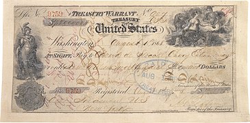
 Introduction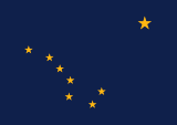   Alaska (/əˈlæskə/ ə-LASS-kə) is a non-contiguous U.S. state on the northwest extremity of North America. It is in the Western United States region. To the east, it borders Canada (the Yukon territory and the province of British Columbia). It shares a western maritime border, in the Bering Strait, with Russia's Chukotka Autonomous Okrug. The Chukchi and Beaufort Seas of the Arctic Ocean lie to the north and the Pacific Ocean lies to the south. Technically a semi-exclave of the U.S., it is the largest exclave in the world. Alaska is the largest U.S. state by area, comprising more total area than the next three largest states of Texas, California and Montana combined, and is the seventh-largest subnational division in the world. It is the third-least populous and most sparsely populated U.S. state, but is, with a population of 736,081 as of 2020, the continent's most populous territory located mostly north of the 60th parallel, with more than quadruple the combined populations of Northern Canada and Greenland. The state contains the second-largest and largest cities in the United States by area: the state capital of Juneau, and its former capital, Sitka, respectively. The state's most populous city is Anchorage and approximately half of Alaska's residents live within its metropolitan area. Indigenous people have lived in Alaska for thousands of years, and it is widely believed that the region served as the entry point for the initial settlement of North America by way of the Bering land bridge. The Russian Empire was the first to actively colonize the area beginning in the 18th century, eventually establishing Russian America, which spanned most of the current state, and promoted and maintained a native Alaskan Creole population. The expense and logistical difficulty of maintaining this distant possession prompted its sale to the U.S. in 1867 for US$7.2 million (equivalent to $157 million in 2023). The area went through several administrative changes before becoming organized as a territory on May 11, 1912. It was admitted as the 49th state of the U.S. on January 3, 1959. Abundant natural resources have enabled Alaska—with one of the smallest state economies—to have one of the highest per capita incomes, with commercial fishing, and the extraction of natural gas and oil, dominating Alaska's economy. U.S. Armed Forces bases and tourism also contribute to the economy; more than half the state is federally-owned land containing national forests, national parks, and wildlife refuges. It is among the most irreligious states, one of the first to legalize recreational marijuana, and is known for its libertarian-leaning political culture, generally supporting the Republican Party in national elections. The Indigenous population of Alaska is proportionally the second highest of any U.S. state, at over 15 percent, after only Hawaii. (Full article...) Entries here consist of Good and Featured articles, which meet a core set of high editorial standards.
 Rika's Landing Roadhouse, also known as Rika's Landing Site or the McCarty Roadhouse, is a roadhouse located at a historically important crossing of the Tanana River, in the Southeast Fairbanks Area, Alaska, United States. It is off mile 274.5 of the Richardson Highway in Big Delta. The roadhouse is named after Rika Wallen, who acquired it from John Hajdukovich and operated it for many years. It became a hub of activity in that region of the interior. With the construction of the ALCAN (now Alaska) Highway and the replacement of the ferry with a bridge downstream, traffic moved away and patronage declined. The roadhouse was added to the National Register of Historic Places in 1976, and is now a centerpiece of Big Delta State Historical Park, also listed on the National Register. (Full article...)TopicsCategoriesSelected article - The Distant Early Warning Line, also known as the DEW Line or Early Warning Line, was a system of radar stations in the northern Arctic region of Canada, with additional stations along the north coast and Aleutian Islands of Alaska (see Project Stretchout and Project Bluegrass), in addition to the Faroe Islands, Greenland, and Iceland. It was set up to detect incoming bombers of the Soviet Union during the Cold War, and provide early warning of any sea-and-land invasion. The DEW Line was the northernmost and most capable of three radar lines in Canada and Alaska. The first of these was the joint Canadian-United States Pinetree Line, which ran from Newfoundland to Vancouver Island just north of the Canada–United States border, but even while it was being built there were concerns that it would not provide enough warning time to launch an effective counterattack. The Mid-Canada Line (MCL) was proposed as an inexpensive solution using bistatic radar. This provided a "trip wire" warning located roughly at the 55th parallel, giving commanders ample warning time, but little information on the targets or their exact location. The MCL proved largely useless in practice, as the radar return of flocks of birds overwhelmed signals from aircraft. The DEW Line was proposed as a solution to both of these problems, using conventional radar systems that could both detect and characterise an attack, while being located far to the north where they would offer hours of advance warning. This would not only provide ample time for the defences to prepare, but also allow the Strategic Air Command to get its active aircraft airborne long before Soviet bombers could reach their targets. The need was considered critical and the construction was given the highest national priorities. Advance site preparation began in December 1954, and the construction was carried out in a massive logistical operation that took place mostly during the summer months when the sites could be reached by ships. The 63-base line reached operational status in 1957. The MCL was shut down in the early 1960s, and much of the Pinetree Line was given over to civilian use. (Full article...)Selected picture - Alaska wild berries from the Innoko National Wildlife Refuge. Photo credit: US Fish and Wildlife Service General imagesThe following are images from various Alaska-related articles on Wikipedia.
Recognized content
Featured articlesGood articles
Featured pictures
Former featured pictures
Related Portals
Related WikiProjectsState facts
State symbols:
Tasks
Associated WikimediaThe following Wikimedia Foundation sister projects provide more on this subject:
Discover Wikipedia using portals |


