
File:Image-Peru and Gran Colombia map in 1828.PNG
Size of this preview: 419 × 600 pixels. Other resolutions: 167 × 240 pixels | 335 × 480 pixels | 651 × 932 pixels.
Original file (651 × 932 pixels, file size: 20 KB, MIME type: image/png)
| This is a file from the Wikimedia Commons. Information from its description page there is shown below. Commons is a freely licensed media file repository. You can help. |

|
This locator map image could be re-created using vector graphics as an SVG file. This has several advantages; see Commons:Media for cleanup for more information. If an SVG form of this image is available, please upload it and afterwards replace this template with
{{vector version available|new image name}}.
It is recommended to name the SVG file “Image-Peru and Gran Colombia map in 1828.svg”—then the template Vector version available (or Vva) does not need the new image name parameter. |
Summary
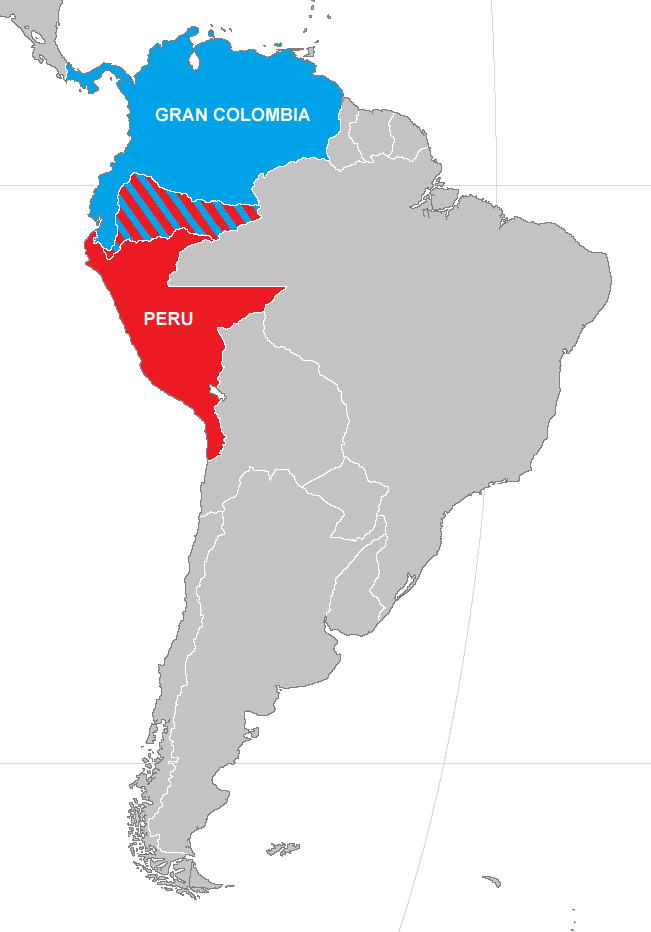
| Description | Map of Peru and Gran Colombia during war of 1828 |
| Date | |
| Source | Made from Image:BlankMap-World.png) |
| Author | Vivaperucarajo |
| Permission (Reusing this file) |
own work |
Licensing

|
Permission is granted to copy, distribute and/or modify this document under the terms of the GNU Free Documentation License, Version 1.2 or any later version published by the Free Software Foundation; with no Invariant Sections, no Front-Cover Texts, and no Back-Cover Texts. A copy of the license is included in the section entitled GNU Free Documentation License. |
| This file is licensed under the Creative Commons Attribution-Share Alike 3.0 Unported license. | ||
| ||
| This licensing tag was added to this file as part of the GFDL licensing update. |
File history
Click on a date/time to view the file as it appeared at that time.
| Date/Time | Thumbnail | Dimensions | User | Comment | |
|---|---|---|---|---|---|
| current | 02:19, 25 April 2019 | | 651 × 932 (20 KB) | Marcomogollon | Texto con los países en disputa |
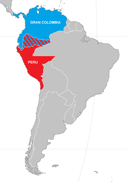
| 17:42, 15 January 2015 |  | 651 × 932 (22 KB) | Milenioscuro | mejora en el mapa | |
| 21:36, 26 April 2008 |  | 420 × 620 (12 KB) | Vivaperucarajo~commonswiki | == Summary == {{Information |Description=Map of Peru and Gran Colombia during war of 1828 |Source=Made from Image:BlankMap-World.png) |Date=2008 |Author=Vivaperucarajo |Permission=own work |other_versions=none }} == Licensing: == {{GFDL}} [[Template: |
File usage
The following pages on the English Wikipedia use this file (pages on other projects are not listed):
Global file usage
The following other wikis use this file:
- Usage on ar.wikipedia.org
- Usage on az.wikipedia.org
- Usage on ca.wikipedia.org
- Usage on es.wikipedia.org
- Usage on fr.wikipedia.org
- Usage on ka.wikipedia.org
- Usage on nl.wikipedia.org
- Usage on sv.wikipedia.org
- Usage on tr.wikipedia.org
- Usage on uk.wikipedia.org
- Usage on vi.wikipedia.org